Showing posts with label Douglas County. Show all posts

Sunday, August 5, 2012

Spruce Mountain


A walk in the woods to me is an exploration of myself because no matter how busy the world seems, when I take the time to walk in the woods I reconnect with who I truly am.  I take the time to appreciate the beauty that the natural world holds for me & I understand the glory of watching a hawk soar & I know that through nature we are all connected.  Each journey I’ve embarked on is unique in its own way & I hope  that the joy I find in each hike inspires you to get out & enjoy everything the natural world has to explore. 

This month’s hike is Spruce Mountain.

Getting there: Spruce Mountain is south of the Denver metro area, go south on I-25 to the Greenland exit (167), turn right (west) at the end of the ramp, you’ll snake around & cross a couple railroad tracks before coming to a stop sign at Spruce Mountain road, turn left (South) & travel about ¼ of a mile parking & the trailhead are on your right.  This is a popular place to go, to get a parking spot I would suggest arriving before 10:00am. 

The Details: The hike is approximately 5.5 miles in a nice loop, the hike begins at approximately 7,100 feet, the highest point is approximately 7,500 feet for a total elevation gain of 400 feet.  This hike will take you 2.5 to 3 hours at a comfortable pace.  Dogs are allowed on a leash. 

The journey:  The trailhead is at the end of the parking lot, we headed due west along a well defined trail for approximately 1/3 of a mile then we turned left & began the ascent to the top of Spruce Mountain.  Within a few hundred feet of the turn you are welcomed by a forest full of pine trees. This hike is a perfect place if you enjoy the smell of pine trees, the entire hike weaves in & out of the pines forest.
The trail up to the top is easy to follow & there are several switchbacks to make the climb even easier.  Along the way you have beautiful views of the Front Range & there are many places to pull off the trail & take in the valley & mountains around you.

Once you’ve reached the top (approximately 1.5 miles) you are on a wonderful flattop mountain.  The next 2.5 miles is just a magnificent stroll along this large flattop mountain.  The views on every side are incredible & the walk along this path is easy & enjoyable. 
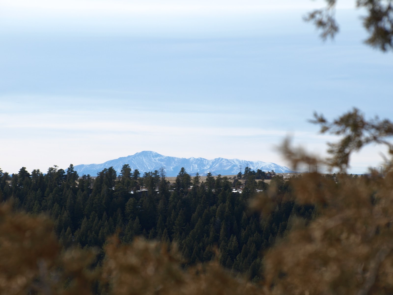
To the South you have views of Pike’s Peak.


  To the south a beautiful valley & the foothills


& to the north more views of the Front Range


This experience was one of my favorite hikes so far, overall it’s a hike that anyone can do even though it’s 5.5 miles.  I would suggest to pack a picnic lunch & sit up top halfway through your hike & enjoy the views.
At the end of the loop you’ll need to take a sharp left to head back down the mountain.  There is a trail sign at this point but it points to the right for those coming up the mountain.  As you continue back down the mountain you’ll come across a point about halfway where you can go to the left or to the right.  The left trail will lead you back to where you came up the mountain, the right trail is an easy decent back to the parking lot. 

Till next time,


Bill

Sunday, July 29, 2012

Castlewood Canyon State Park

The moments we share with the ones we love are priceless & for me sharing the beauty of the natural world with family & friends can’t be beat.  Part of our family are two wonderful dogs, Sydney & Adelaide.  They are Australian Cattle Dogs & we love being able to take them on adventures with us.
This month we visited Castlewood Canyon State Park in Franktown.  To get there take I-25 south to Founders Parkway/ CO-86, go east about 12 miles & turn south onto Castlewood Canyon Road.  This is the west entrance to the park & there is no visitors center here.  You’ll need $7 cash for the entrance fee that you’ll put into an envelope at the entrance.  Park in the Westside trailhead parking lot.
The trail we took was a combination trail that when put together becomes a perfect loop of this lovely canyon.  The total length was 4 ¾ miles & took us approximately 2.5 hours.  Starting from the parking lot you walk  for about .2 miles on the Falls Spur trail, when you reach the end of this trail we turned left onto the Creek Bottom trail.  This trail begins at approximately 6,400 feet & continues slowly downward into the canyon.
The views from this trail are truly breathtaking as you walk along Cherry creek.  After continuing for about 1 mile you’ll come to the next trail on this journey, it’s called Rimrock trail.  This trail will lead you up to the sheer cliffs of the canyon.  The trail moves down at first & then back up to the top of the canyon, an elevation gain of approximately 300-400 feet.

After you catch your breath from the climb you walk right to the end of the canyon & you can then see the entire front range.  The trail at this point is over the flat rocks of the canyon top & a fairly easy journey with incredible views.  This trail continues for about 2 miles till you reach the Dam trail.


This trail brings you back down to the bottom of the canyon with a fairly steep descent.  The total length of this trail is only a bit more than a ¼ of a  mile but we found this part of the hike difficult because of the steepness of the descent.
Once you reach the bottom you connect again with the Creek Bottom trail & continue right along Cherry creek until you find your way back to the Falls Spur trail & back to the parking lot.  The great thing about doing the hike the way we did it was on this last spur of the Creek Bottom trail we could see where we were at the top of the canyon.
We did this hike on a beautiful day in January but I advise you to bring clip-on’s or something else for your boots to deal with the ice.  Since the Canyon looms over much of the trail in the winter,  it is a bit treacherous at times.  The dogs never had an issue but we were walking very carefully in many places.  Dogs are allowed in the park & on this trail as long as they are leashed.  I encourage you to enjoy this wonderful & very different place.
Till next time,
 
Bill

The Bluffs

Often in my life trying to find time to get away & enjoy the outdoors is a challenge, since I’ve moved to Colorado that challenge has grown because I long to be out in the beauty we have around us every day.  I have enjoyed exploring this state & look forward to continuing to find the best places to go & be a part of nature.  I thank all of you for your comments & suggestions & hope over the coming years I can see all the places that you each hold so dear.

Even though the mountains are close for many of us, when I don’t have the time to run away to even the foothills, I’ve found a place that warms my heart & allows me to see the front range in all its glory!  This place is called Bluffs Regional Park, it’s located off of I-25 south of Denver.  The easiest way to get there is to get off at Lincoln Avenue go west to Yosemite turn left (South) there’s a sign approximately ¼ of a mile on your right side to turn & go to the end of the road.  The park is free & accessible with dogs or by bike if you prefer.
The hike itself allows you to see panoramic views of Denver, the Denver Tech Center & much of the front range.  There’s plenty of parking most days & the path is fairly easy.  The total hike is approximately 2 ¾ miles with an elevation gain of only 250ft or so.  The trail is well marked & there are two separate side trails you can take to overlooks that are amazing.
When leaving the parking lot the trail splits to the right & left (this is a loop trail), I have always gone to the right by doing this you avoid the greatest elevation gain till about halfway through the hike.  If you choose to go to the left the elevation gain is immediate.
The trail is very winding & moves through an urban area that is surrounded by many houses.  The rolling hills that make up The Bluffs hide & reveal these houses at various points throughout the hike.  After walking for 1/3 of a mile or so, you get your first look at the City of Denver off to your right.  As you continue on the path the front range opens up in front of you & all the glory of mountains can be seen.

The path continues to meander through these rolling hills as you reach the halfway point you make a turn back towards the parking lot, this is when the hike can become a bit difficult as within approximately ¼ of a mile you walk up the highest of the Bluff’s hills.  Once you reach the top there’s a path to your left that leads to one of the two lookouts, I encourage you to checkout both of these view points as you can see for miles in all directions.  If you choose to continue to the right in a few hundred feet there’s a trail that goes to the left to the second lookout.  I enjoy this spot the best as you can see the trail below.

After leaving the last lookout you work your way back to the parking lot.  The total hike should take you between 1 – 1.5 hours & is lovely in any kind of weather.  In the summer months you’ll want to pay more attention to the bikers but overall for an urban hike this one can’t be beat.

Till next time,

Bill