The journey I take when I walk through the woods is more to
me than just the discovery of the beauty of nature, it is truly the discovery
of myself. For when I walk amongst the
natural world I find a quiet & peace within me that I know nowhere else.
This month’s journey is to a beautiful place in Jefferson
County , Deer Creek Canyon. To get there
take C-470 to Wadsworth Avenue South, turn right at South Deer Creek Canyon
Road go approximately 4 miles to Grizzly Drive turn left and wind your way for
¼ to a ½ of mile to the parking (on your right).
The trails we took again created our own loop the total hike
is approximately 2.7 miles, it begins at an elevation of 5,950 & peaks at a
height of 6,450. The total elevation
gain is 500 feet & it’s a glorious romp through the foothills that gives you
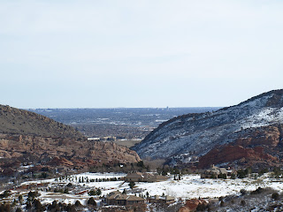
amazing views of the Front Range, Denver & the surrounding Deer Creek
Canyon area. I would consider this hike
an urban hike as it’s nestled in a neighborhood but rarely do you see the
homes, businesses or any reference to the neighborhood.
 On this trail you are allowed to bring your dogs as long as
they are leashed. We began on the
Meadowlark Trial which starts right from the parking area & heads west into
the foothills. The
trail winds through the hills & in & out of pines & gamble
oaks. The elevation gain begins after
about ½ a mile but because of the switchbacks & winding trail in general
you don’t really feel the elevation gain like so many other trails. The red rocks on the walls
of the canyon around this area are beautiful anytime of the year but I love the
way the white snow sets off the colors all around you.
The Meadowlark trail is only open to hikers so there’s no
concern on this part of the trail for bikers or people on horseback. After continuing for about a mile you reach
the highest point of this hike the views all around you are amazing as you can
see most of the Front Range as well as Denver.

Once you’ve taken in the views from the top you begin to
slowly move back down. You’ll leave any
thought of being in an urban neighborhood behind as you wind between two hills
& into an alpine forest. At the end
of the Meadowlark trail you’ll cross a bridge & turn to your left. The evergreen trees envelop you as you start
back towards the parking lot. In addition to the evergreens you have sections
of the trail that have large boulders. You follow this section of the trail for
approximately ½ a mile once you leave the forest behind. You’ll have a hard turn to your
left. This section of the trail isn’t
well marked ahead is Plymouth Creek Trail which Meadowlark trail runs right
into if you continue straight you’ll
continue back up a steep climb.
Instead, follow the Plymouth Creek trail back to your left & you’ll
wind your way back to the parking lot in just over a mile.
This hike was a lovely way to spend a couple of hours. We enjoyed the views & the topography of
this hike a lot. I encourage you to
check it out when you have a chance.
Till next time,
Bill


No comments:
Post a Comment